
Recently Published
Circulars

The History of Patuxent: America’s Wildlife Research Story
U.S. Geological Survey Circular 1422
Edited by: Matthew C. Perry
Estimated use of water in the United States in 2015
U.S. Geological Survey Circular 1441
By: Cheryl A. Dieter, Molly A. Maupin, Rodney R. Caldwell, Melissa A. Harris, Tamara I. Ivahnenko, John K. Lovelace, Nancy L. Barber, and Kristin S. Linsey
Scientific Investigations Reports
Surface-water quality in the Lycoming Creek watershed, north-central Pennsylvania, August 1–3, 2011
U.S. Geological Survey Scientific Investigations Report 2017–5154
By: Dennis W. Risser and Matthew D. Conlon
Monitoring the water-quality response of agricultural conservation practices in the Bucks Branch watershed, Sussex County, Delaware, 2014–16
U.S. Geological Survey Scientific Investigations Report 2018–5020
By: Judith M. Denver, Alexander M. Soroka, Betzaida Reyes, Todd R. Lester, Deborah A. Bringman, and Michael S. Brownley
Hydrogeology of, simulation of groundwater flow in, and potential effects of sea-level rise on the Kirkwood-Cohansey aquifer system in the vicinity of Edwin B. Forsythe National Wildlife Refuge, New Jersey
U.S. Geological Survey Scientific Investigations Report 2017–5135
By: Alex R. Fiore, Lois M. Voronin, and Christine M. Wieben
Hydrologic assessment of the Edwin B. Forsythe National Wildlife Refuge
U.S. Geological Survey Scientific Investigations Report 2017–5088
By: Christine M. Wieben and Mary M. Chepiga
Status and threats analysis for the Florida manatee (Trichechus manatus latirostris), 2016
U.S. Geological Survey Scientific Investigations Report 2017–5030
By: Michael C. Runge, Carol A. Sanders-Reed, Catherine A. Langtimm, Jeffrey A. Hostetler, Julien Martin, Charles J. Deutsch, Leslie I. Ward-Geiger, and Gary L. Mahon
Hydrogeologic framework and hydrologic conditions of the Piney Point aquifer in Virginia
U.S. Geological Survey Scientific Investigations Report 2017–5041
By: E. Randolph McFarland
Open-File Reports
Longshore water-current velocity and the potential for transport of contaminants—A pilot study in Lake Erie from Walnut Creek to Presque Isle State Park beaches, Erie, Pennsylvania, June and August 2015
U.S. Geological Survey Open-File Report 2016–1206
By: Elizabeth A. Hittle
Factors affecting long-term trends in surface-water quality in the Gwynns Falls watershed, Baltimore City and County, Maryland, 1998–2016
U.S. Geological Survey Open-File Report 2018–1038
By: Emily H. Majcher, Ellen L. Woytowitz, Alexander J. Reisinger, and Peter M. Groffman
Determining the sources of fine-grained sediment using the Sediment Source Assessment Tool (Sed_SAT)
U.S. Geological Survey Open-File Report 2017–1062
By: Lillian E. Gorman Sanisaca, Allen C. Gellis, and David L. Lorenz
Toxicity assessment of sediments collected upstream and downstream from the White Dam in Clarke County, Georgia
U.S. Geological Survey Open-File Report 2018–1036
By: Peter J. Lasier
Characteristics of peak streamflows and extent of inundation in areas of West Virginia and southwestern Virginia affected by flooding, June 2016
U.S. Geological Survey Open-File Report 2017–1140
By: Samuel H. Austin, Kara M. Watson, R. Russell Lotspeich, Stephen J. Cauller, Jeremy S. White, and Shaun M. Wicklein
Freshwater mussel survey for the Columbia Dam removal, Paulins Kill, New Jersey
U.S. Geological Survey Open-File Report 2018–1074
By: Heather S. Galbraith, Carrie J. Blakeslee, Jeffrey C. Cole, and Erik L. Silldorff
Assessment of skin and liver neoplasms in brown bullhead (Ameiurus nebulosus) collected at the Ashtabula River Area of Concern and associated reference site, Ohio, in 2016
U.S. Geological Survey Open-File Report 2018–1072
By: Vicki S. Blazer, Heather L. Walsh, and Ryan P. Braham
Fact Sheets
Landslide monitoring in the Atlantic Highlands area, New Jersey
U.S. Geological Survey Fact Sheet 2017–3068
By: Pamela A. Reilly, Francis X. Ashland, and Alex R. Fiore
U.S. Geological Survey—Virginia Department of Transportation: Bridge scour pilot study
U.S. Geological Survey Fact Sheet 2018–3006
By: Samuel H. Austin
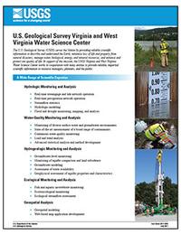
U.S. Geological Survey Virginia and West Virginia Water Science Center
U.S. Geological Survey Fact Sheet 2017–3059
By: John D. Jastram
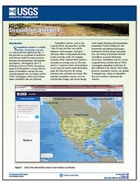
StreamStats, version 4
U.S. Geological Survey Fact Sheet 2017–3046
By: Kernell G. Ries III, Jeremy K. Newson, Martyn J. Smith, John D. Guthrie, Peter A. Steeves, Tana L. Haluska, Katharine R. Kolb, Ryan F. Thompson, Richard D. Santoro, and Hans W. Vraga
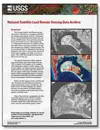
National Satellite Land Remote Sensing Data Archive
U.S. Geological Survey Fact Sheet 2018–3027
By: John L. Faundeen and Ryan Longhenry
For more information contact:
John Doe, Publishing Service Center Chief
USGS West Trenton Publishing Service Center
5522 Research Park Dr.
Baltimore, MD 21228
555-555-5555
Email